- Home
- / Alessandro Malaspina of Mulazzo
- / Which Asian country's coast did the Malaspina Expedition map?

Which Asian country's coast did the Malaspina Expedition map?
Thailand
Japan
Philippines
Indonesia
Answer
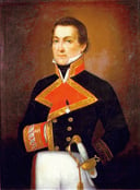
The Philippines coastline was meticulously charted during the Malaspina Expedition, a pivotal scientific expedition led by Spanish naval officer Alejandro Malaspina in the late 18th century. The expedition's extensive mapping efforts not only contributed to the understanding of the Philippine's geography but also provided valuable insights into the region's natural resources and indigenous populations, enriching the world's knowledge of this Southeast Asian archipelago.
Exploring the Legacy of Alejandro Malaspina: A Quiz on the Spanish Explorer
More Questions
How many years did the Malaspina's scientific expedition in the Pacific Ocean last?
Malaspina’s expedition also visited a country in the Southern Hemisphere. Which one?
How long did the Malaspina Expedition last in total?
On which islands did the Malaspina Expedition stop?
Apart from being an explorer, what was Alejandro's role in the Spanish navy?

Subscribe Now!
Learn something
new everyday
Playing quizzes is free! We send 1 quiz every week to your inbox